01 • Route Reference
Start from Riyadh and navigate toward Salbukh Dam and the nearby heritage ruins using the public Gaia GPS waypoint and map layer.
Featured Story
A close-to-Riyadh escape where dry desert lines meet seasonal water channels, old mud-brick traces, and quiet viewpoints for photography, camping, and reflection.
The Place
Salbukh is a memorable overlanding stop northwest of Riyadh, often visited for its dam landscape, open desert setting, and winter-season atmosphere after rainfall. The area can feel completely different depending on the season — dry and graphic in summer, or dramatic and reflective when water collects behind the dam.
Near the dam, old heritage ruins and mud-brick structures offer a glimpse into the traditional settlement character of the Najd region. These ruins are best approached with care and respect: photograph, observe, and leave the place exactly as found.
Route Map
AR OVERLAND ROUTE REFERENCE
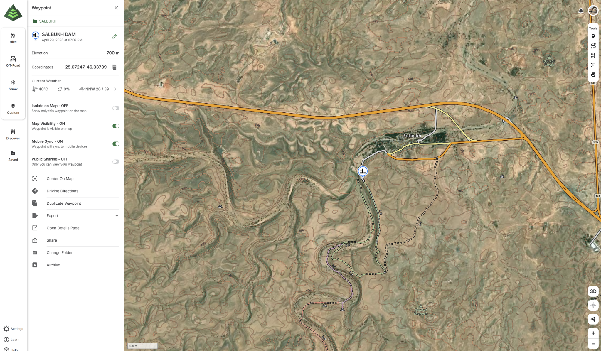
Preview image shown for reliable loading. Tap the map or buttons to open the full public Gaia GPS route.
Start from Riyadh and navigate toward Salbukh Dam and the nearby heritage ruins using the public Gaia GPS waypoint and map layer.
Use Gaia GPS before departure to review road access, contour lines, off-road tracks, and the latest waypoint position on your device.
Photo Placeholders
Watch & Share
A quick escape can still become
a meaningful expedition.— AR Overland